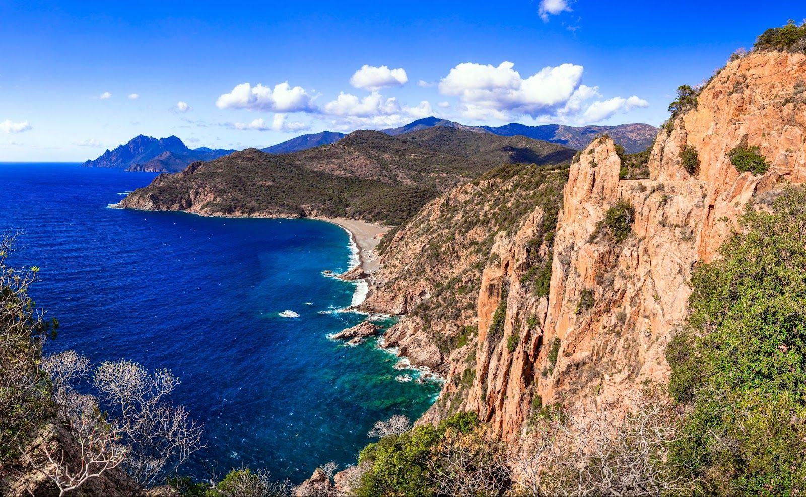
Cycling is one of the best ways to explore new places, but some destinations feel out of reach. High mountain roads, deep jungle valleys, or remote borderlands can be hard to access and even harder to plan for.
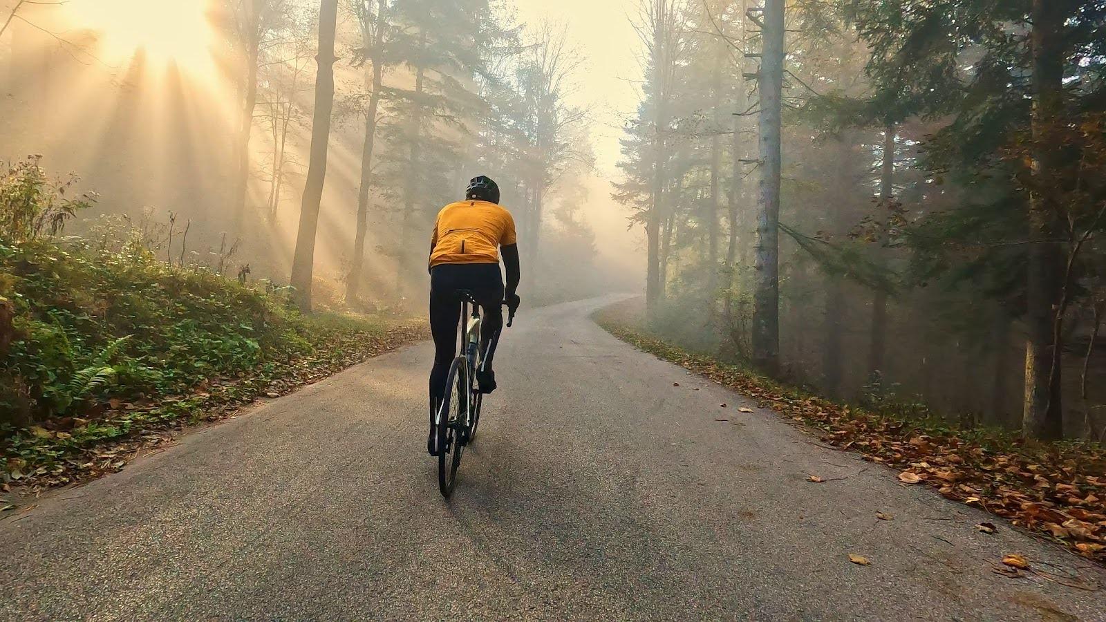
That’s where ROUVY comes in. The Great World Adventure #2 takes you on a virtual cycling journey through Sri Lanka, Tajikistan, and Bolivia, bringing real roads and landscapes from across the globe to your indoor trainer.
Across twelve stages, you’ll climb, coast, and explore through a mix of cultures, climates, and natural wonders, from ancient temples and misty highlands to dramatic mountain passes and Amazon foothills.
This challenge is not only about fitness; it’s about curiosity, culture, and connection. Every route has a story to tell, giving you the chance to ride through places you might never visit in person, but can now experience as if you were really there.
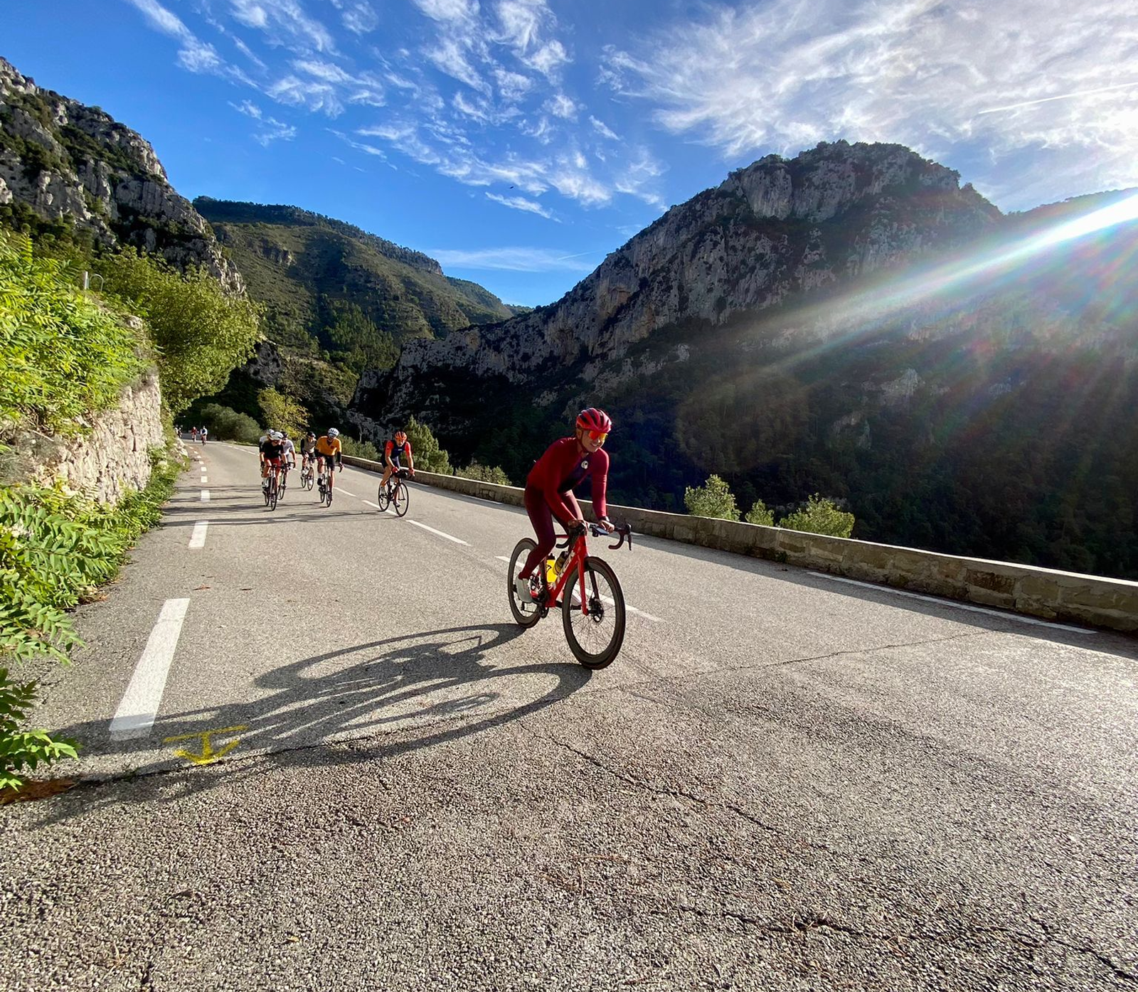
Stages one to four: Cycling in Sri Lanka
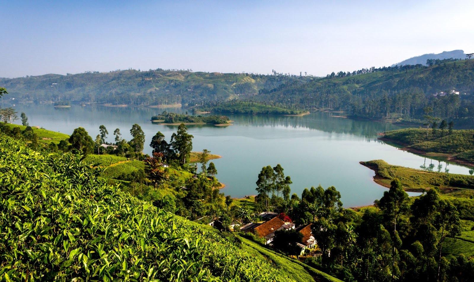
Sri Lanka, with its diverse mix of coastline, highlands, and cultural landmarks, is an ideal setting for adventure. The first stages of the challenge take you deep into the country’s centre, where tea country meets sacred peaks and ancient fortresses.
Around Castlereagh Reservoir
This 16 km loop circles the Castlereagh Reservoir in Sri Lanka’s hill country, starting north of the lake and travelling clockwise through Summerville and Norwood before finishing near Kuda Maskeliya.
The route passes through some of the region’s most scenic tea estates, where green terraces blanket the hillsides and narrow lanes wind between workers’ cottages and colonial-era bungalows. Around Summerville, the road climbs gently through pine groves and plantation roads scented with eucalyptus. At Norwood, you ride past active tea factories and estate villages alive with daily work.
There are occasional glimpses of the Castlereagh Reservoir below, but most of the route offers a view over rolling hills and misty valleys rather than open lake scenery.
Highlight: A quiet ride through classic Sri Lankan tea country.
Pros: Gentle gradients, cooler climate, and peaceful rural surroundings.
Cons: Narrow roads and limited views of the reservoir.
Fun fact: The Norwood and Castlereagh tea estates were established in the late 19th century and still produce some of Sri Lanka’s finest Ceylon teas.
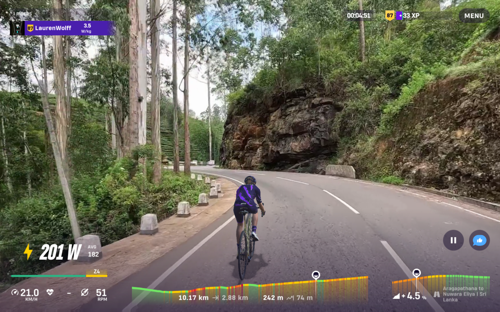
Aragapathana to Nuwara Eliya
This route moves through the heart of Sri Lanka’s tea country. Aragapathana, a small plantation town, leads to winding roads lined with tea estates established during British colonial times. The ride leads to Nuwara Eliya, often called “Little England” for its cool climate, Tudor-style houses, and well-tended gardens. Surrounded by mountain peaks, the town sits at nearly 1,900 metres, making it one of the highest points you can cycle to.

- Highlight: Sweeping views across tea plantations with the backdrop of Pidurutalagala, Sri Lanka’s tallest mountain.
- Pros: Cooler weather and consistently scenic climbs.
- Cons: Narrow roads can become congested with more traffic during Sri Lankan holidays.
- Fun fact: The tea grown here is considered among the best Ceylon tea globally and is exported globally.
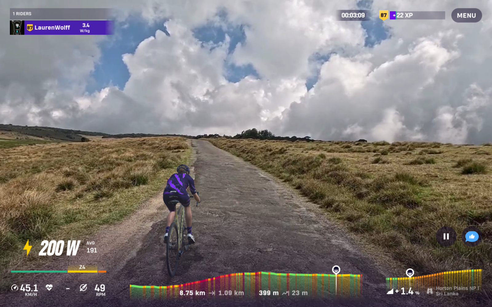
Horton Plains National Park
Located a short ride from Nuwara Eliya, Horton Plains is a unique plateau at an elevation of over 2,000 metres. Its grasslands and cloud forests are home to sambar deer, purple-faced langurs and over 20 endemic bird species. For cyclists, the approach roads skirt the park's edge, offering sweeping views of the mountains, often cloaked in mist. Within the park, “World’s End” is a sheer cliff with a 1,000-metre drop, and Baker’s Falls, a 20-metre cascade.
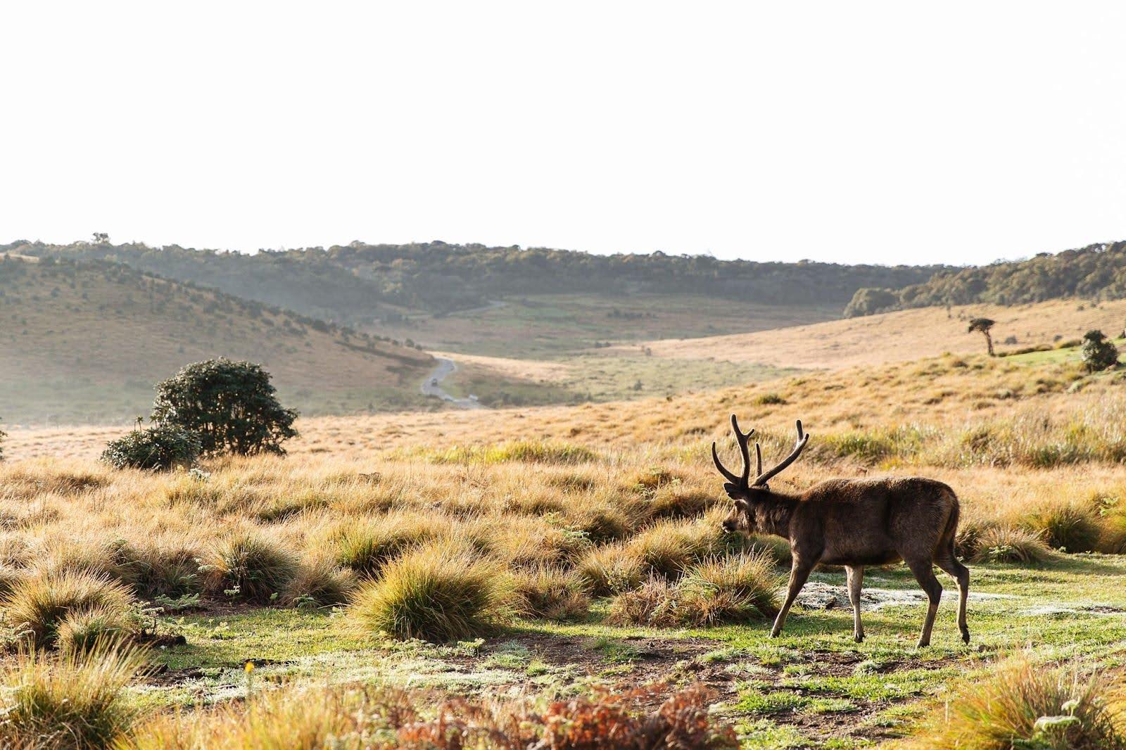
- Highlight: The World’s End viewpoint and the highland plateau atmosphere.
- Pros: Refreshing climate and rare ecosystems.
- Cons: The park restricts cycling, so only nearby roads are accessible in real life.
- Fun fact: Horton Plains is the source of three major Sri Lankan rivers: the Mahaweli, Kelani and Walawe.
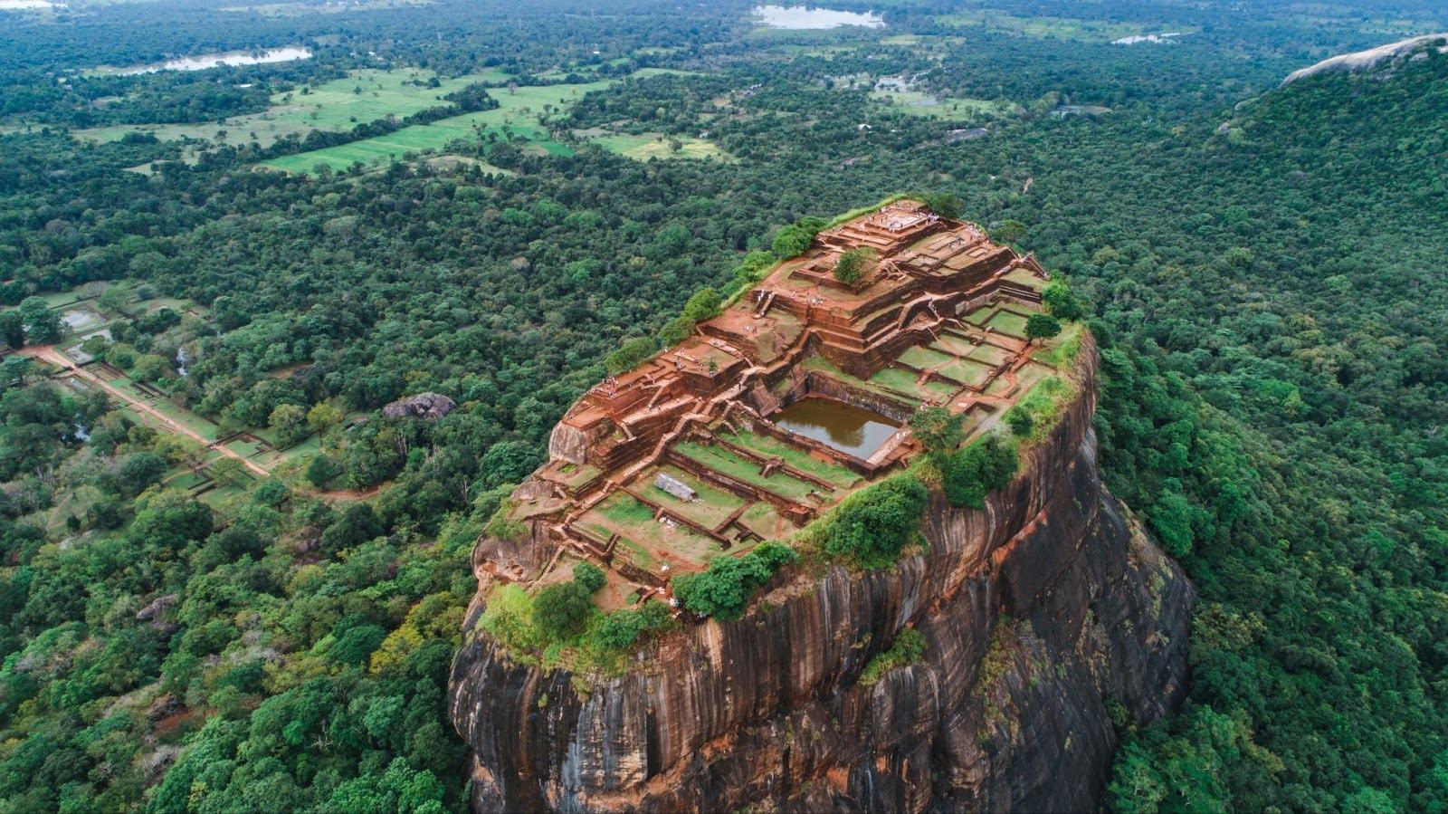
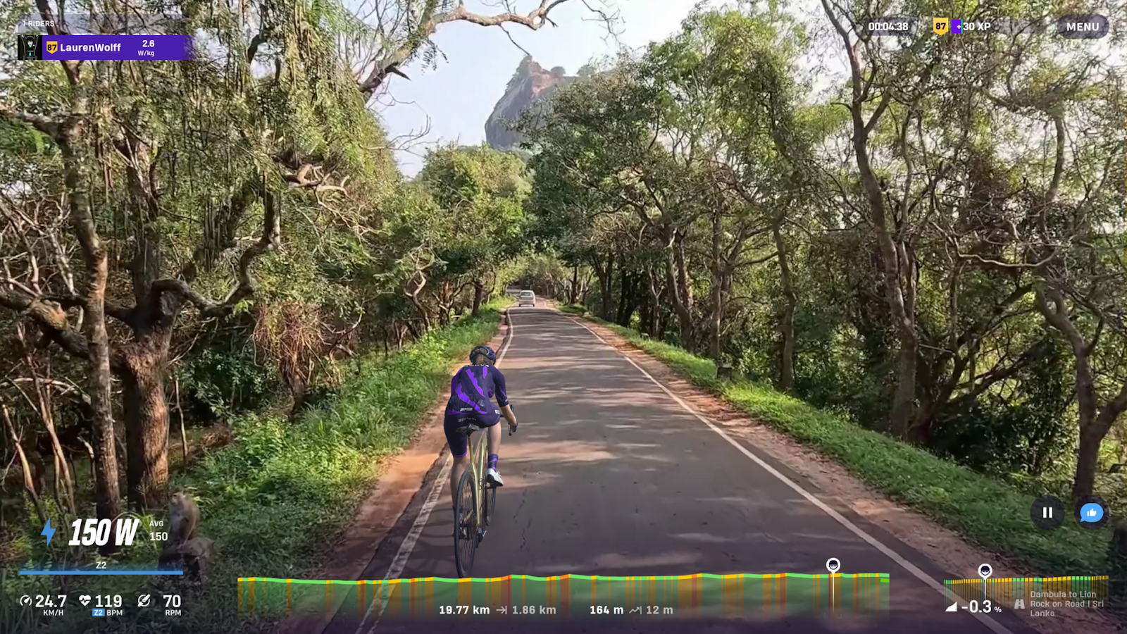
Dambulla to Lion Rock, Sigiriya
This route begins in Yapagama, travels to Kimbissa, and then reaches Sigiriya. It follows quiet rural roads through Sri Lanka’s Cultural Triangle, surrounded by paddy fields, palm trees, and small villages.
Passing through Dambulla, one can spot the Dambulla Cave Temple, one of Sri Lanka’s oldest and most significant Buddhist sites. The road then opens into farmland and forest as it heads north towards Sigiriya, where the shape of Lion Rock comes into view above the trees.
The final stretch passes near the entrance to the Sigiriya Rock Fortress, a 200-metre granite outcrop that once held an ancient royal citadel. Keep a lookout!
- Highlight: The sight of Sigiriya’s Lion Rock rising above the forest.
- Pros: Smooth roads and scenic access to Sri Lanka’s historic heartland.
- Cons: Strong sun and occasional wildlife along the roadside.
- Fun fact: Sigiriya is a UNESCO World Heritage Site often called the “Eighth Wonder of the World”.
Stages five to eight: Cycling in Tajikistan
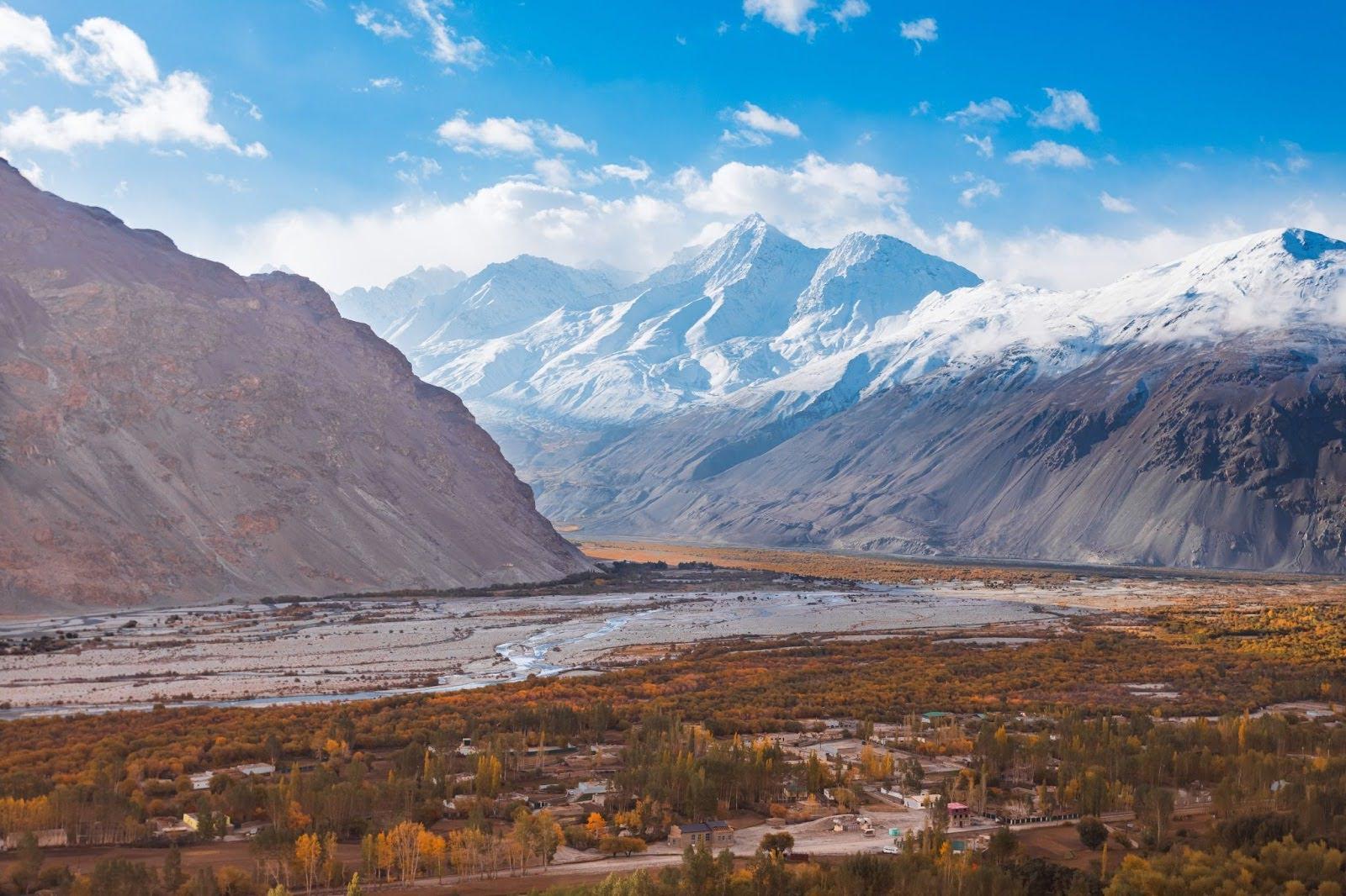
Tajikistan is situated in the heart of Central Asia, bordered by Afghanistan, Uzbekistan, Kyrgyzstan, and China. Its dramatic mountain landscapes and remote valleys form part of the ancient Silk Road, a trade route connecting China with Europe for over 1,500 years. Travelling these roads today feels like stepping through history, where isolated communities still live close to the land.
Zerafshan Valley
The Zerafshan Valley cuts through northern Tajikistan, surrounded by the Zerafshan Mountain Range. Its name means “spreader of gold”, a reference to the fine mineral-rich dust carried by the river. The valley once played a key role in Silk Road trade, with caravans moving through to Samarkand and beyond.
Today, one can experience quieter rural roads, green fields and a mix of cultural influences that reflect centuries of trade and exchange. On ROUVY, the route offers moderate climbs and long, smooth descents through fertile farmland and apricot orchards.
- Highlight: Views of the Zerafshan Range and traditional farming villages.
- Pros: Gentle gradients, good road conditions, welcoming communities.
- Cons: Few tourist facilities between towns.
- Fun fact: Apricots from this region are among Central Asia’s most prized exports, still traded as they were centuries ago.
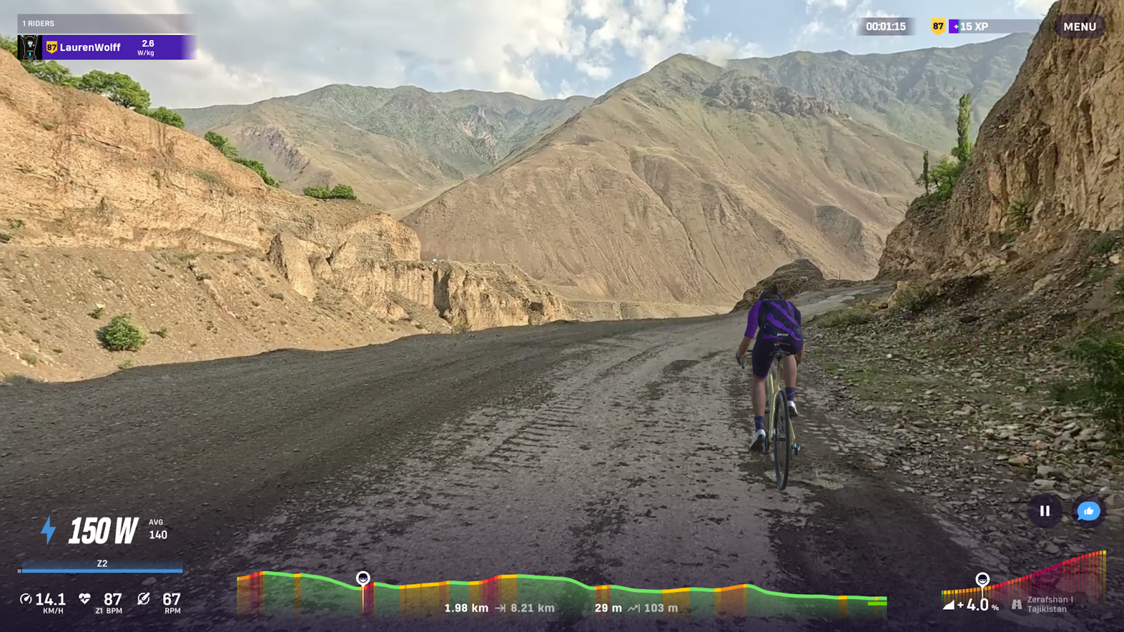
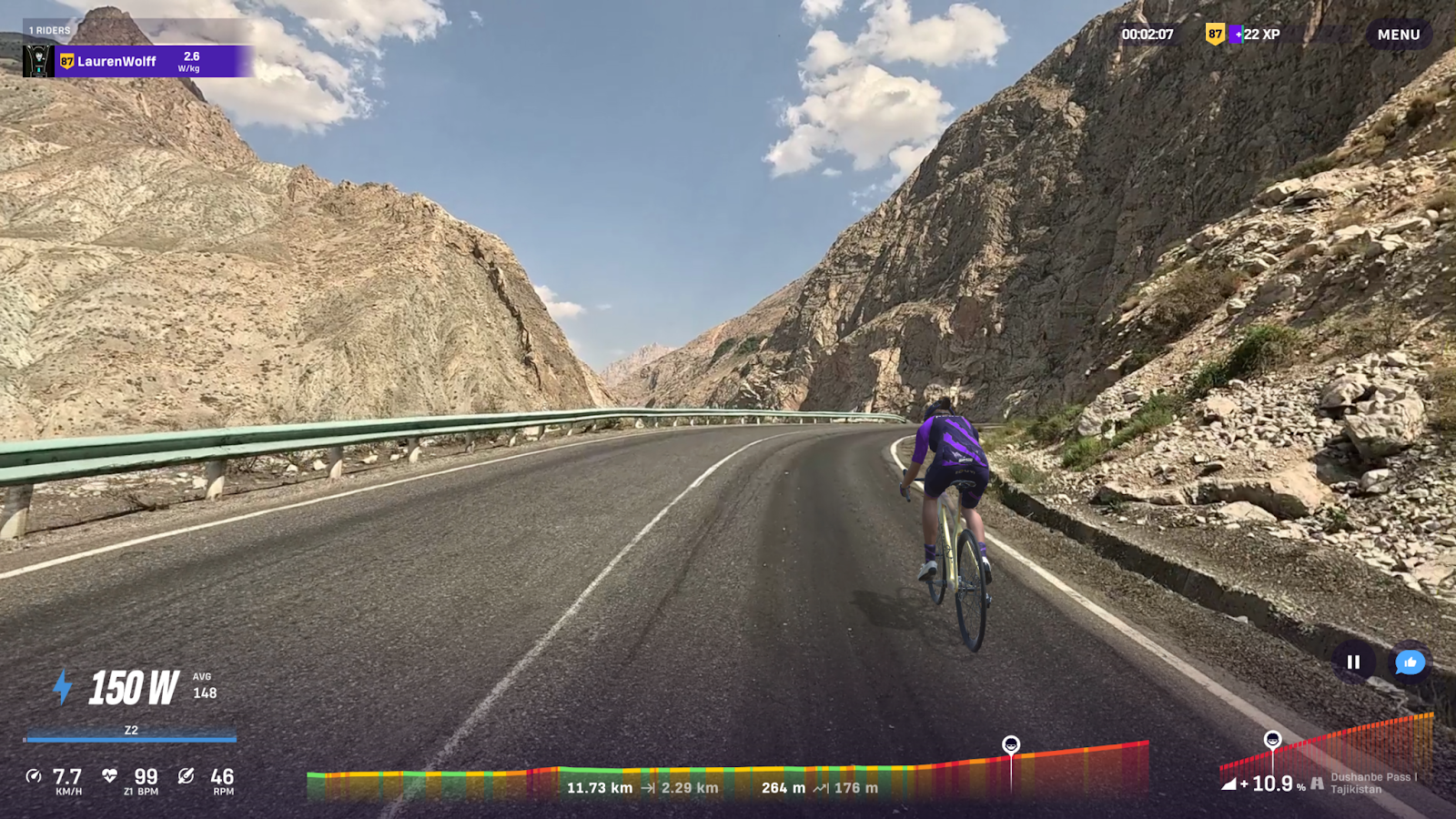
Dushanbe Pass
The Dushanbe Pass route follows a main road heading east from the capital into the mountains. It leads you through the narrow Varzob Gorge before climbing steadily towards the highlands near Rabot and Takfon. The early part of the ride runs along a well-paved road bordered by red and ochre rock faces shaped by centuries of wind and water erosion. Sparse vegetation lines the roadside, and small mountain villages appear occasionally, offering glimpses of local life in this remote part of Tajikistan.
The scenery changes as you leave the lower valley: the slopes become steeper, the air cooler, and the road begins to rise more sharply. The final 4 kilometres are a demanding uphill stretch, with gradients testing endurance and pacing. It’s a steady, sustained climb where every turn reveals more towering peaks ahead.
Cycling here combines open, exposed terrain with constant elevation gain. The landscape consists of cliffs, dry riverbeds, and switchbacks leading towards the distant mountain pass.
- Highlight: The long, exposed climb through the Varzob Gorge.
- Pros: Quiet roads, smooth tarmac, and mountain scenery close to Dushanbe.
- Cons: Long climbs and high afternoon temperatures.
- Fun fact: The P501 forms part of the road network that eventually links to the Pamir Highway, one of Central Asia's highest and most famous routes.
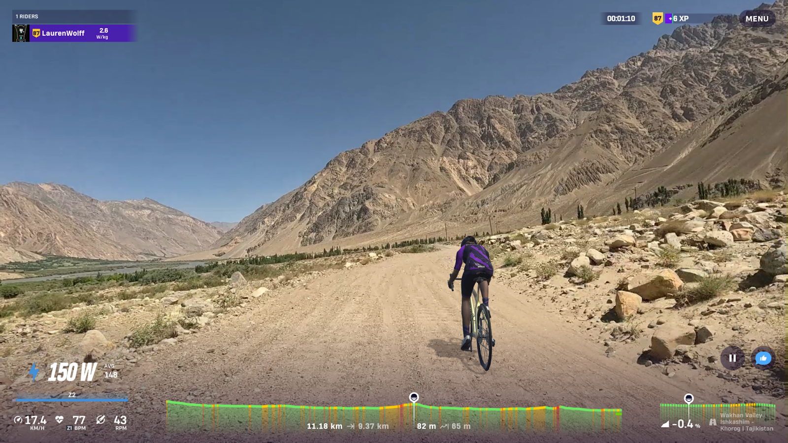
Wakhan Valley, Ishkashim to Khorog
The Wakhan Valley is one of Tajikistan’s most striking areas, running alongside the Panj River and separating the Pamir Mountains from Afghanistan’s Hindu Kush. This road passes through quiet villages where traditional Pamiri homes are built from stone and wood, and where many families still live as they have for generations.
You’ll explore part of the historic Silk Road through an isolated and unspoilt area. The route offers incredible scenery, including mountain peaks, ancient fort ruins, and terraced fields.
- Highlight: Riding alongside the Panj River with views into Afghanistan.
- Pros: A genuine sense of remoteness and cultural authenticity.
- Cons: Basic amenities; remote conditions.
- Fun fact: The Wakhan Corridor has long served as a buffer zone between empires and a vital link on the ancient Silk Road, connecting traders from East and West.
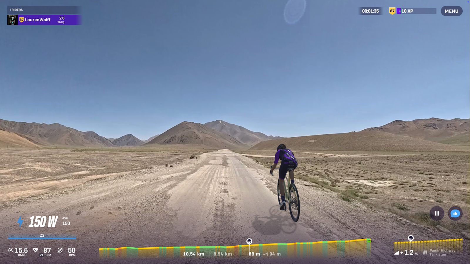
Pamir Highway
Known as the M41, the Pamir Highway is one of the world’s highest roads, crossing the mountains at altitudes above 4,000 metres. It links Dushanbe with Osh in Kyrgyzstan and remains an important connection for people in this isolated region. The road surface can be rough, and conditions change quickly with the weather, but it is considered one of the great overland routes for the brave seeking hardcore adventure.
- Highlight: The Ak-Baital Pass, reaching 4,655 metres above sea level.
- Pros: Remote and scenic.
- Cons: Harsh climate, thin air, and unpredictable road conditions.
- Fun fact: Built during the Soviet era, the M41 followed the ancient Silk Road route through the Pamirs and remains one of the highest international highways in the world.
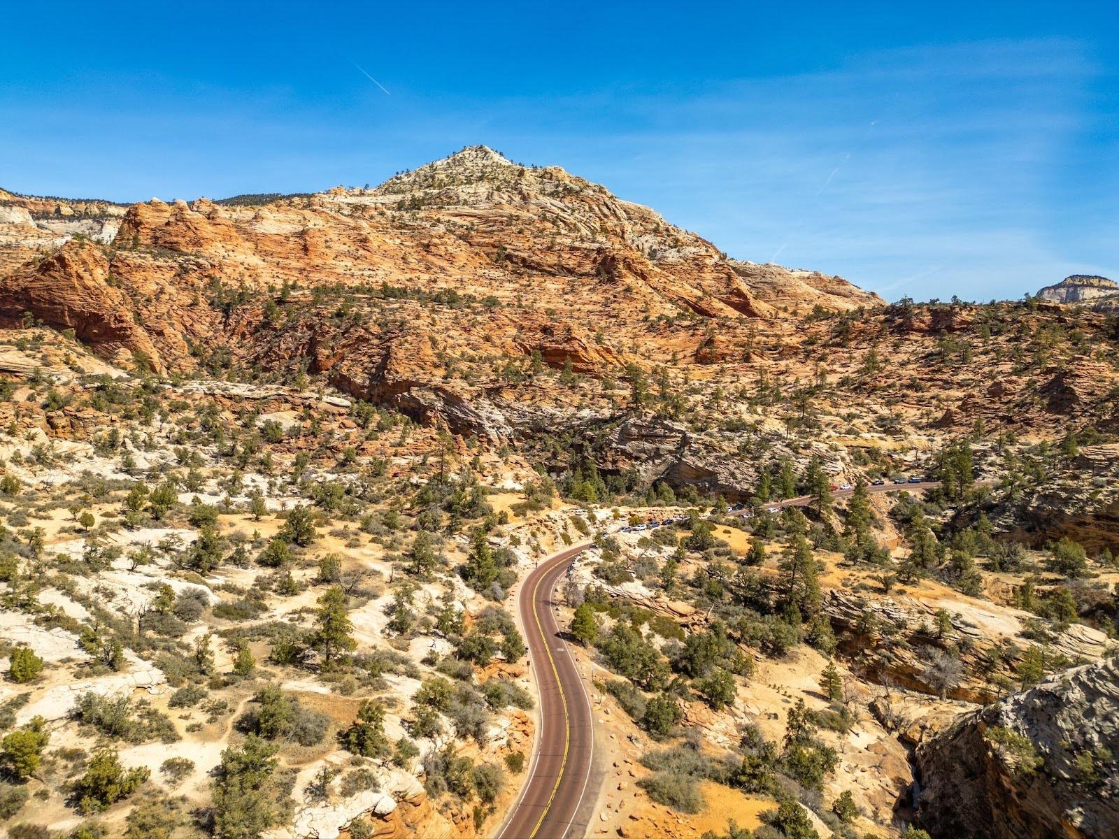
Stages nine to twelve: Cycling in Bolivia
Bolivia offers some of the most varied and dramatic terrain in South America, from the Andes Mountains to the lowland rainforests of the Amazon Basin. It is a country of contrast and altitude, where every route reveals a new environment, from icy passes to tropical plains. These stages take you through the country’s most unique regions, showcasing its diversity and natural beauty.
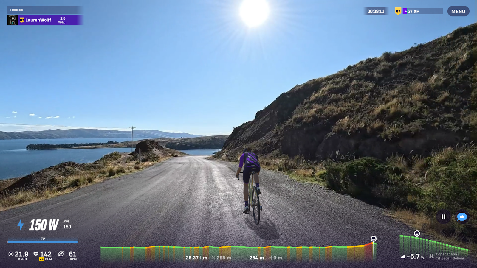
Copacabana, Lake Titicaca
Copacabana is situated on the southern shore of Lake Titicaca, the world's highest navigable lake, at an elevation of 3,812 metres. This stage follows the lakeside road, offering broad views across the water towards the distant Cordillera Real mountains. The lake holds deep cultural significance. It was once a centre of Inca civilisation, and many of its islands, such as Isla del Sol, are linked to Inca legends about the birth of the sun god.
- Highlight: Sweeping views over Lake Titicaca at the end of the route.
- Pros: Smooth tarmac and scenic lakeside roads.
- Cons: High altitude can affect breathing and performance if you are there.
- Fun fact: Lake Titicaca, shared by Bolivia and Peru, is considered the cradle of Andean culture.
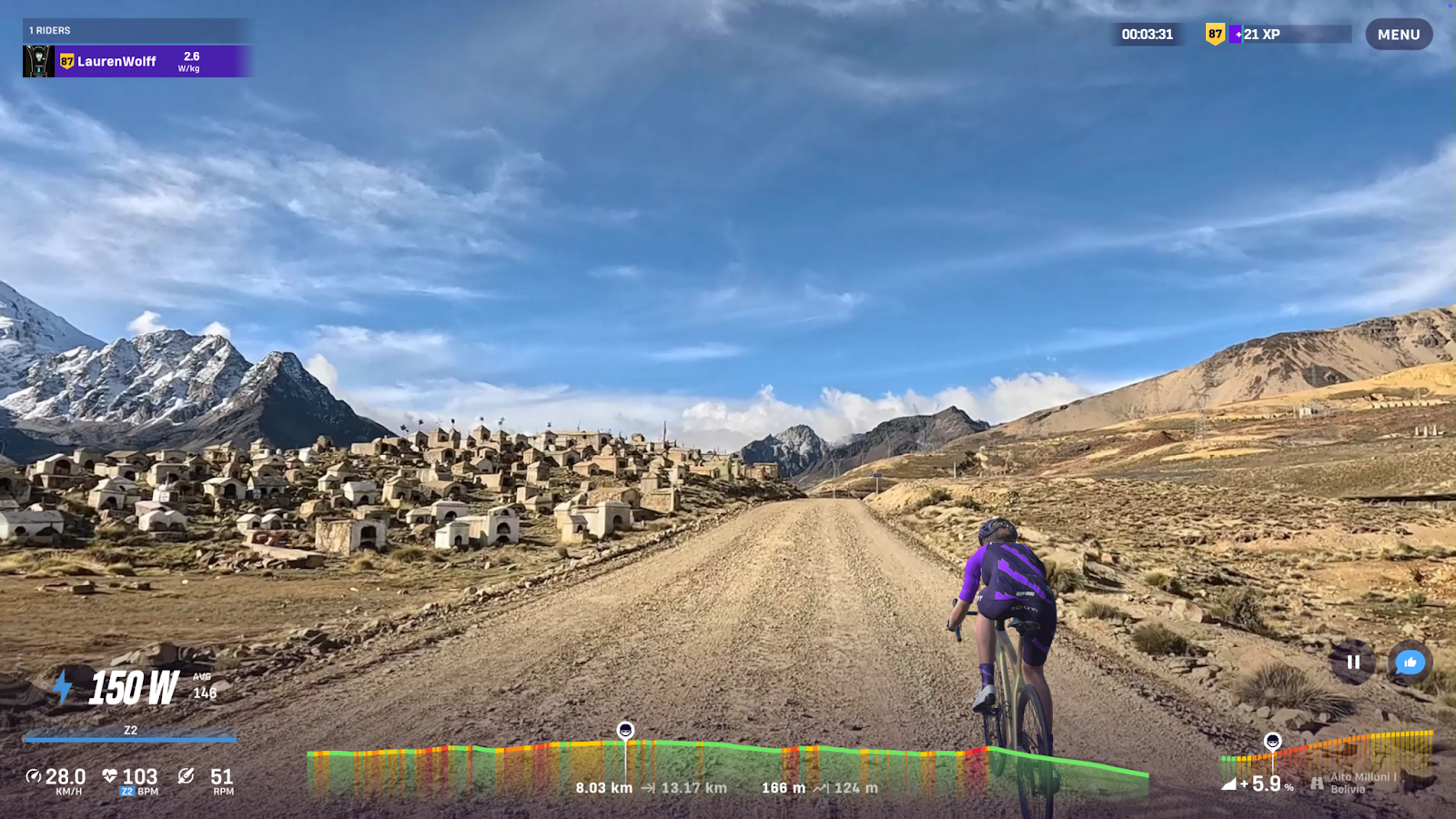
Alto Milluni
Alto Milluni is situated near El Alto, one of the highest major urban areas in the world, located at approximately 4,300 metres. The area is best known for the Milluni cemetery, a striking site set against the stark, dramatic Andean landscape. The cemetery’s tombs and murals combine indigenous Aymara symbolism with colonial and Christian influences, creating an open-air display of Bolivian culture and craftsmanship.
Passing through the area, one encounters a rich history and heritage. During the annual Day of the Dead celebrations, families visit the cemetery to decorate graves with flowers, food, and offerings, turning the site into a colourful and communal remembrance of those who have passed.
- Highlight: The Milluni cemetery, situated at the foot of Mount Huayna Potosí (the peak stands at 6,088m), is known as one of the most accessible peaks in the world.
- Pros: A fascinating cultural route close to La Paz and El Alto.
- Cons: High altitude and cold, dry air make the visit challenging.
- Fun fact: The Milluni cemetery is called an open-air museum for its vibrant tombs and artefacts, which reflect centuries of Bolivian history and culture.
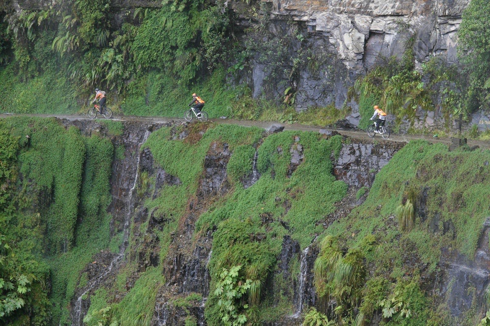
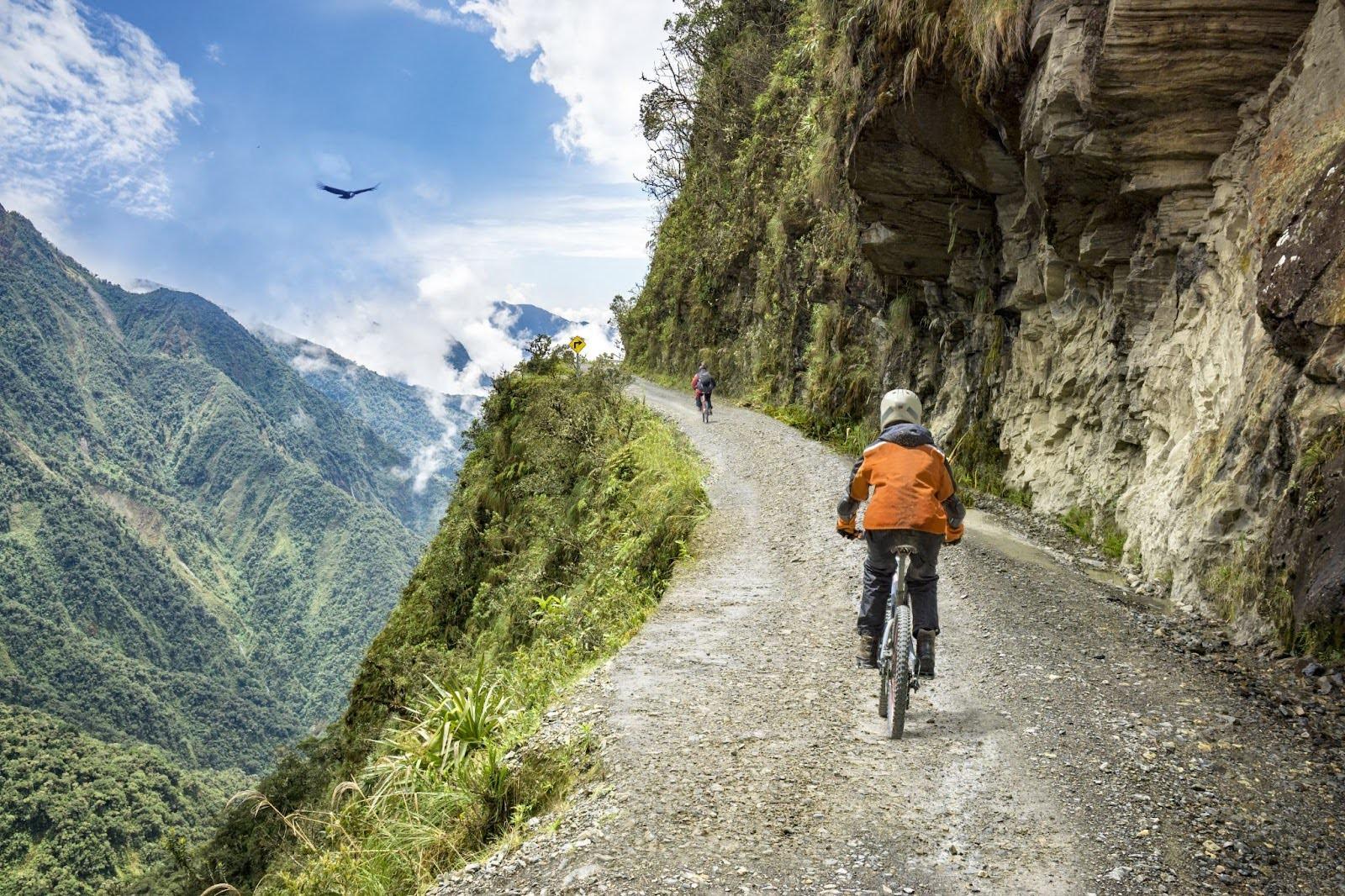
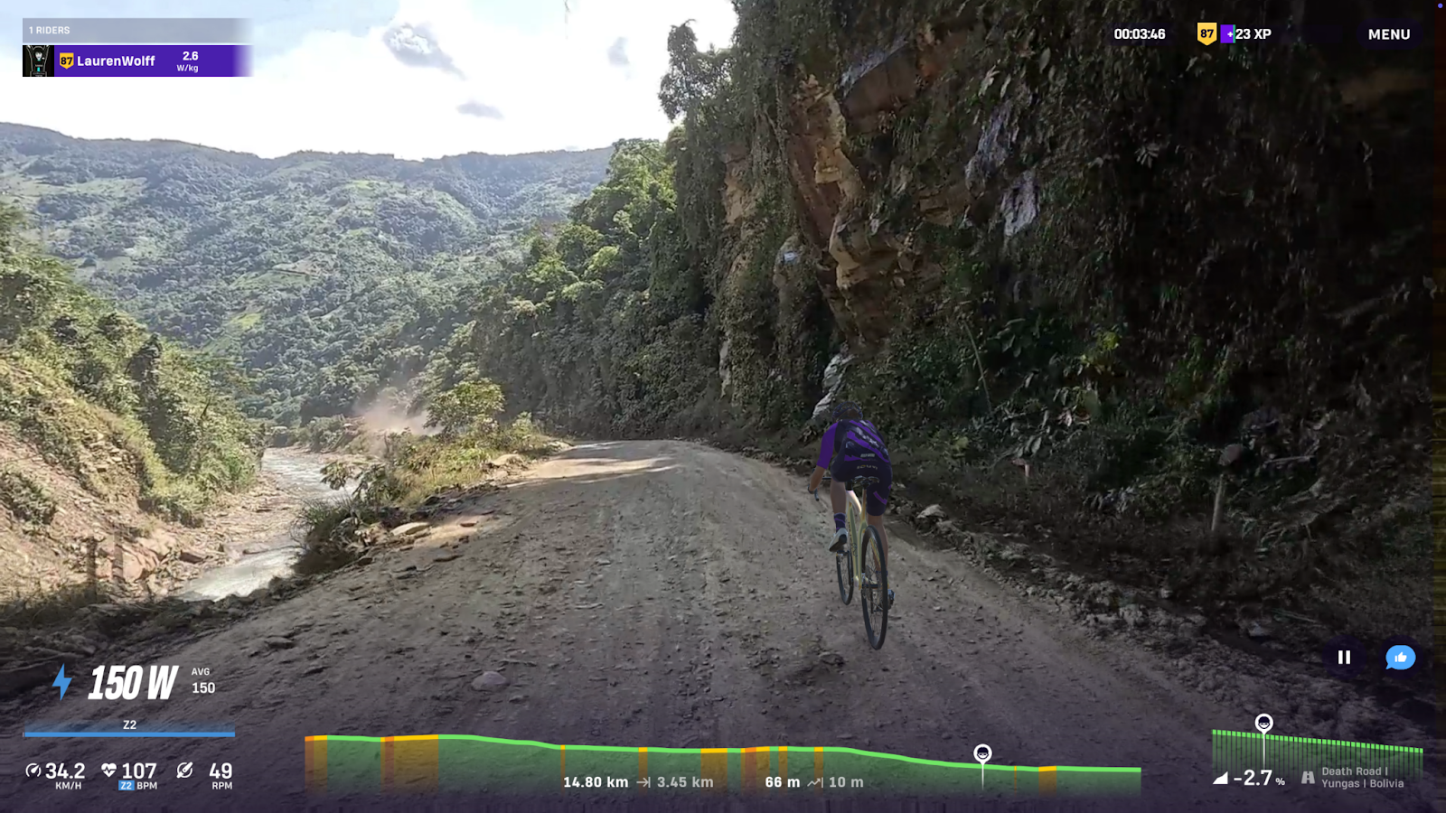
Death Road, Yungas Road
The Yungas Road, often called the “Death Road”, is one of Bolivia’s most famous routes. It descends from the Andes near La Paz into the subtropical Yungas region, dropping from around 4,700 metres to below 1,200 metres in less than 70 kilometres. The road is narrow, cut into steep mountainsides, and bordered by dense vegetation.
Although newer asphalt has been laid in places, the old route remains open to cycling and adventure tours. The descent offers a dramatic change in temperature and scenery, moving from icy peaks to humid jungle.
- Highlight: The descent from the high Andes into the green Yungas valleys.
- Pros: A unique and scenic challenge with massive altitude variation.
- Cons: Steep drops, loose gravel, and variable weather conditions.
- Fun fact: Before the new road opened in 2006, this was one of the busiest and most dangerous roads in South America, with hundreds of vehicles using it daily.
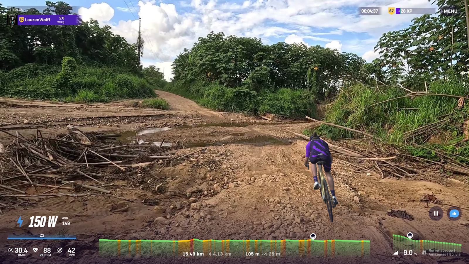
Rurrenabaque, Amazon Basin
Rurrenabaque marks a sharp contrast to Bolivia’s mountain routes. Situated on the edge of the Amazon Basin, it lies only about 400 metres above sea level. The area is warm, humid, and rich in wildlife, with the Beni River flowing past the town and into the rainforest. Cycling here means shifting from mountain climbs to rolling jungle roads lined with palms and thick tropical vegetation.
Rurrenabaque is a starting point for eco-tours into the Madidi National Park, one of the most biodiverse regions on the planet.
- Highlight: Lush lowland scenery and the transition from the Andes to the Amazon.
- Pros: Gentle gradients and an entirely different environment from the highlands.
- Cons: Hot, humid weather and frequent rain.
- Fun fact: Madidi National Park, near Rurrenabaque, is home to over 11% of the world’s known bird species.
Your passport to discovery on ROUVY
The Great World Adventure is a wonderful opportunity to explore parts of the world that are often beyond reach. Every route is a chance to expand your horizons, from temples in Sri Lanka to remote valleys in Tajikistan and high-altitude roads in Bolivia. Your passport to discovery is here! Join the Great World Adventure, pack your curiosity, and ride through some of the planet's most remarkable and remote landscapes on real routes: the lush tea plantations of Sri Lanka, the high peaks and lowland jungles of Bolivia, and the dramatic mountain passes of Tajikistan. Whether you are chasing fitness, new scenery, or the joy of riding with friends, this is a one-of-a-kind experience you can only get on ROUVY.